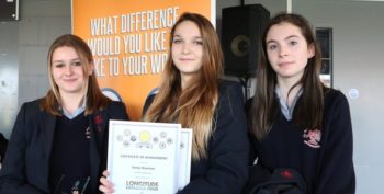
Longitude Explorer Prize 2015
What was the Longitude Explorer Prize 2015?
We challenged young people aged 11-16 to shift from solely being consumers of satellite applications, which have a significant impact on almost every aspect of their lives, to become the creators, designers and developers of a whole new generation of satellite applications for social good.
Why did we do this?
2014 marked the 300th anniversary of the original Longitude Prize, the first incentive prize of its kind set up by the British government. In celebration, we launched the Longitude Explorer Prize, a youth-focused challenge for secondary school students which aimed to provide a practical education opportunity linking young people to the history of the Longitude Prize, while supporting them to develop STEM skills.
Our overarching objective was to inspire the next generation of inventors, designers, engineers and explorers to develop the skills required for the 21st century and to imagine a world beyond our current comprehension, which is imperative to the success of UK industry.
What happened?
A total of 67 entries were received from across the UK. Sixty ideas were selected and the teams were invited to an induction event held in Birmingham at the national Big Bang Fair, which is a celebration of science, technology, engineering and maths for young people in the UK.
In August 2015, the judges whittled it down to 12 finalists. The selected finalists were given a couple of months to further develop their prototypes, polish their presentation skills and finalise marketing resources to showcase their technologies at the Final Awards event in London. At the Award Ceremony the winning school was awarded £25,000, each runner up received £5,000 and all students received individual prizes, including iPads, Raspberry Pi kits, SamLabs kits and trophies.
Sign up to our newsletter to be the first to know about future challenges.
About the prize
67 teams took part…
from all over the UK, including Ireland
250 young people…
were involved throughout the lifecycle of the Prize
For 90% of young people…
this was the first challenge they had been involved in
Impact of the Prize
- 72% of teachers considered the Challenge a suitable learning tool for young students
- 100% of the teachers from the finalist teams would take part again and recommend the Challenge to a colleague
- 83% of students rated the Challenge as very good or excellent
- 91% of students stated that they gained a better understanding of how to bring an idea into market
- 73% of the students developed good additional STEM skills thanks to the Challenge
- 75% of students stated that the Challenge was very useful in learning how to turn ideas into reality
- 70% of students said the teamwork-building skills were very useful
Winner – Displaced – Tromless Hackers (Rendcomb College)

‘Displaced’ is a cloud-hosted mobile web app that uses live GPS data collected from mobile devices to allow local charities to better coordinate the logistics of supporting homeless and vulnerable people.
The finalists
-
Fast Aid – Jeremy Team (Churston Ferrers School)
Fast Aid is a data collection and navigation tool to be located in ambulances which will help crews to check live data about nearby hospitals including details of available beds and facilities. They were second runner-up in the Prize.
-
Land Identifier – Team Just (Spalding High School)
To help farmers and agronomists in the developing world to measure and map soil moisture in real time, to maximise the potential crop yield.
-
MapShot – Dalriada Robotics (Dalriada School)
Enables users to take scientific readings from satellites and upload them to a global online forum where they can be converted into infographics. The visualisations can promote discussion and collaboration between researchers in different fields.
-
Planet Fitness – GALL (Thomas Deacon Academy)
An app which uses GPS satellite information to track users during open-air exercise, customising outdoor workout programmes to location and person.
-
Proximity Safety Unit – Salutem Aviation (Okehampton College)
An aviation system that relays live stream data via satellite systems directly from a plane to ground control and data collection posts, enabling investigators to immediately discover key flaws in a plane’s flight or instruments.
-
Riversearch for Schools – The Warwick Wizards (The Warwick School)
To enable groups to monitor sections of watercourse or pond, and to measure biological and chemical indicators to determine the ecological status.
-
Safety.net – Keep Me Safe (Sutton Grammar School)
Based on their own experiences, the team came up with the idea Safety. net that enables teachers to see where their students are at all times thanks to wristbands and a simple app. They were first runner-up in the Prize.
-
Sun Watch – The Inventors (Spalding High School)
A piece of wearable tech which uses satellite and UV index information to warn users if they are in danger of skin damage due to exposure to the sun.
-
SafeHaven – The White Van Man (Thomas Deacon Academy)
A tool which uses GPS information to map safe places for young people when they are feeling vulnerable or threatened. Once activated, the nearest safe haven will be alerted.
-
Bee there – Bee there (Churston Ferrers Grammar School)
A tracking system which uses satellite information and crowdsourced reporting to locate local bee groupings, allowing scientists to study how the environment and location might affect population numbers.
-
ZAPP – QWERTY (Churston Ferrers Grammar School)
An alarm clock app which employs live open data on traffic, public transport disruption and weather to work out the best time to wake users in order to meet the demands of their schedule.


